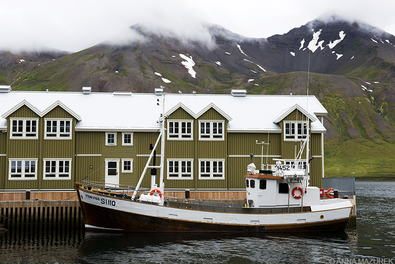
Siglufjörður, a remote fishing village in Northern Iceland, has only been accessible by road since 1940.
My country count hit 46 when I stepped off the plane in Iceland. And, it was by far the most beautiful place I’ve ever been!
How could I NOT fall in love with a place filled with stunning waterfalls, glacier lagoons, lava fields, fluffy horses, endless summer sunlight and puffins? That’s right – PUFFINS!!
Iceland has been on my radar since my friend James moved to Reykjavik three years ago. Both the cost and geography kept me away. And, the fact that I was in South America for most of last year. Meanwhile, every photo James posted on Instagram looked like an Iceland tourism ad.
My travels always revolve around the light and stunning scenery. Iceland was no exception. I planned my route solely based on the landscape and light. I choose the summer for the warmer weather and endless light. (The sun never fully sets!)
Here’s a recap of my trip along with the best things to do in Iceland and where to avoid:
Reykjavik
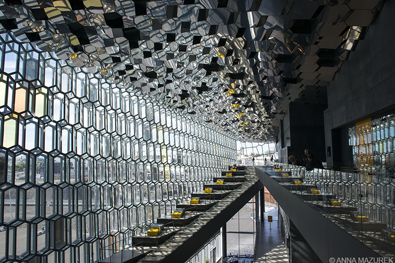
Harpa, Reykjavik’s stunning concert hall, opened in 2011. The building itself is free to the public all day and has free wifi!
I arrived in the capital city of Reykjavik with a heat wave – a sweltering 61°F! Overall, it’s a cute city that’s worth a day or two of exploring. It’s also the the best place for shopping! Harpa, the main concert hall, is gorgeous. I took the elevator to the top of the famous church, Hallgrímskirkja. Since I’m prone to museum fatigue, I skipped most of the museums except for the Museum of Iceland, which was informative. The food was excellent – the fish and chips at Reykjavik Fish was so good I went twice. Glo is a great lunch spot. I took a ferry from Harpa to a small island called Viðey, which is a nice way to spend a few hours.
Southern Iceland
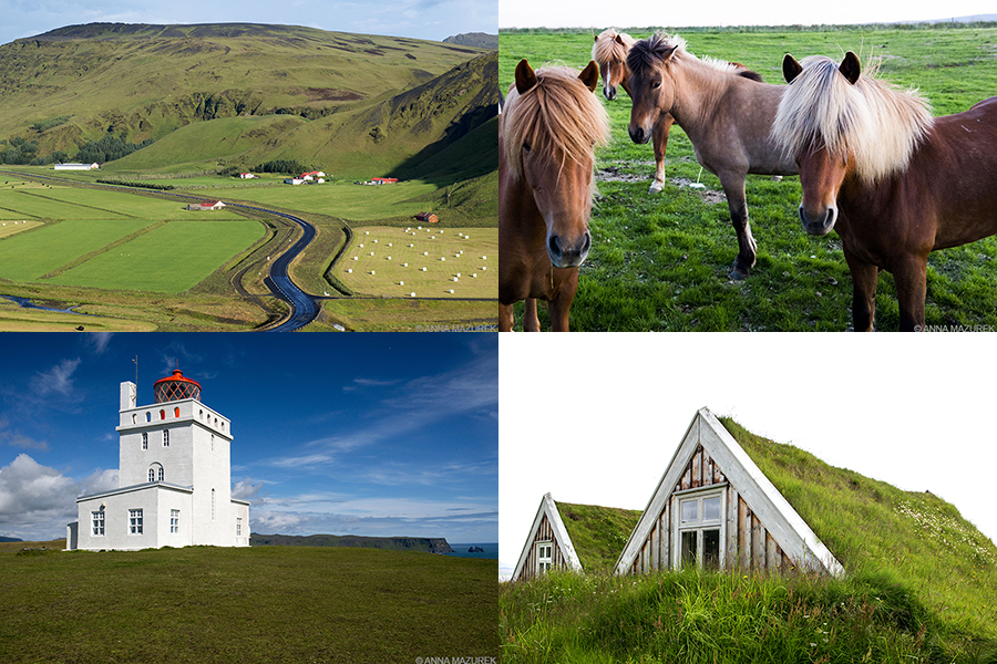
Clockwise from top left: Route 1, Icelandic horses, turf hoses at Sel near Svartifoss and the lighthouse at Dyrhólaey.
Southern Iceland won the scenery jackpot. It is jam packed with the majority of the must-see sites in the country. The best way to explore is to drive Route 1, known as the ring road. The two-lane paved road is an 828-mile loop around the country with a 55 mph speed limit. Who doesn’t love a good road trip?
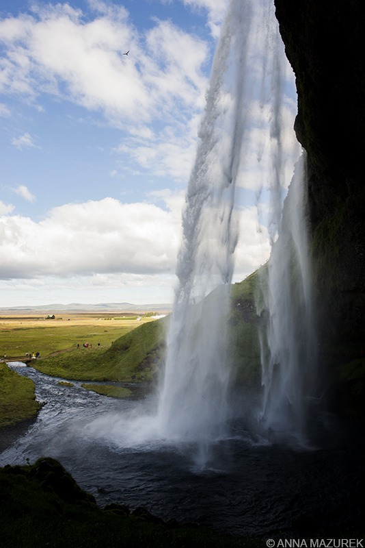
Seljalandsfoss Waterfall, Southern Iceland
My friend James and I headed explored the South in his car. Our first stop was Seljalandsfoss, the famous waterfall that you can walk behind, and the hidden cave waterfall, Gljúfrabúi, next door. Prepare to get wet!
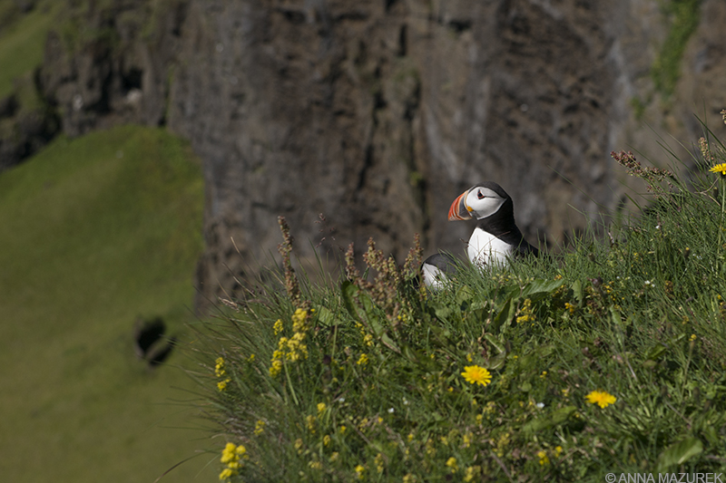
The cliffs at Dyrhólaey were filled with puffins, who frequent the area from April to September.
Our next stop was Dyrhólaey, a set of cliffs with an arch formation. It offers a great view of the black sand beaches and other rock formations. Most importantly, it’s home to a cute lighthouse hotel and PUFFINS. Literally, every cliff was filled with puffins!
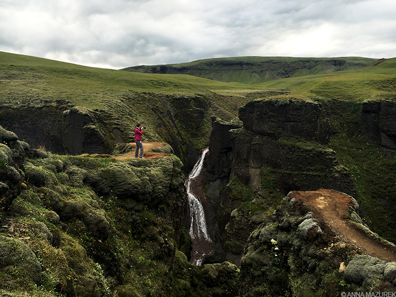
My friend James took this amazing shot of me at Fjaðrárgljúfur, a deep canyon between Vik and Skaftafell.
We stopped in the nearby town of Vik to visit James’ friend who runs a bed and breakfast. She suggested we stop at a 100-meter deep canyon called Fjaðrárgljúfur en route to our campground at Skaftafell. The best part of travel are the little tips from locals – neither James or I had heard of the place. It ended up being one of the most amazing places from my trip and just a short detour off the ring road!
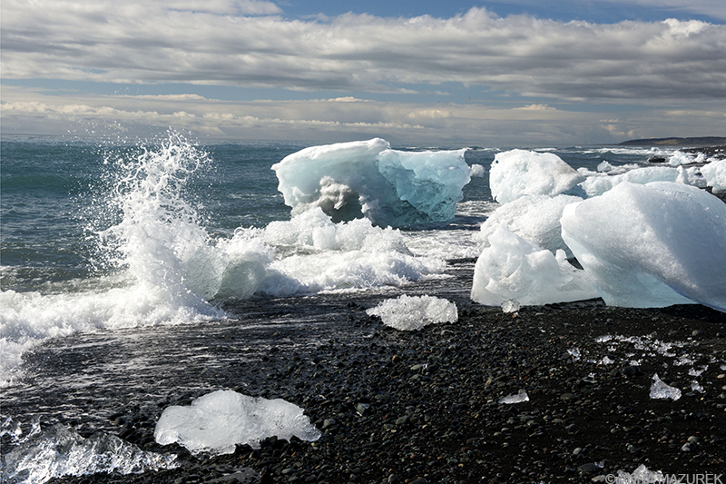
Icebergs wash up on the black pebble beaches near the lagoon at Jökulsárlón.
Jökulsárlón, the glacier lagoon, was phenomenal. I spent a few hours wandering around the lagoon. Be sure to visit the beach on the east side of the bridge for the best photos of mini-icebergs washed up on the shore. Afterwards, we went back to Skaftafell to do the short hike to my favorite waterfall, Svartifoss. The falls are surrounded by basalt columns, dark rock formations created by lava that cooled rapidly. A short hike from the waterfall led to the turf houses at Sel. Turf houses are scattered around the country, but these were my favorite due to the remote setting. (Plus, they were FREE!)
We stopped back in Vik that night to meet James’ friend for dinner. We hung out at her B&B with her guests and staff – a Polish bat expert, an Austrian couple and a French translator. We talked politics and tried rotten shark meat, an Icelandic delicacy. (It tastes better than it smells!) Since it was pouring rain that night, we couldn’t be bothered to put up our tent so we slept in the car. (The best road trips always involve sleeping in cars!)
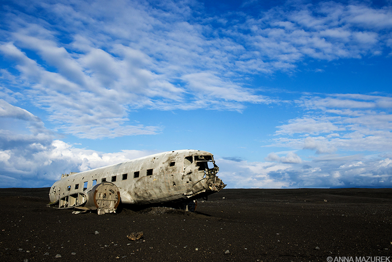
The famous wreck of an old plane near Vik is no longer accessible by car so be prepared to walk!
To avoid crowds, we got up at sunrise to hike to the eerie wreckage from the U.S. Navy DC plane that crashed in 1973. (Everyone survived!) The site is a 4 km walk from the main road on Sólheimasandur beach near Vik. (GPS: 63°27‘32.8“N 19°21‘53.2“W) There’s no sign on the main road, but there is usually a large amount of cars parked at the entrance to the path. Afterwards, we stopped by Skógafoss that afternoon. The waterfall is stunning, and you can usually see a rainbow in the mist. The hike to the top is worth it!
Golden Circle
I borrowed James’ car one day and went to the Golden Circle, which is made of three spots – shooting geysers (surrounded by crowds of people), Gullfloss waterfall and a Þingvellir National Park, home of Iceland’s first parliament. All sites were super touristy and not as exciting as everything I’d seen in the South. Skip the Golden Circle and spend more time driving the ring road!
Snæfellsnes
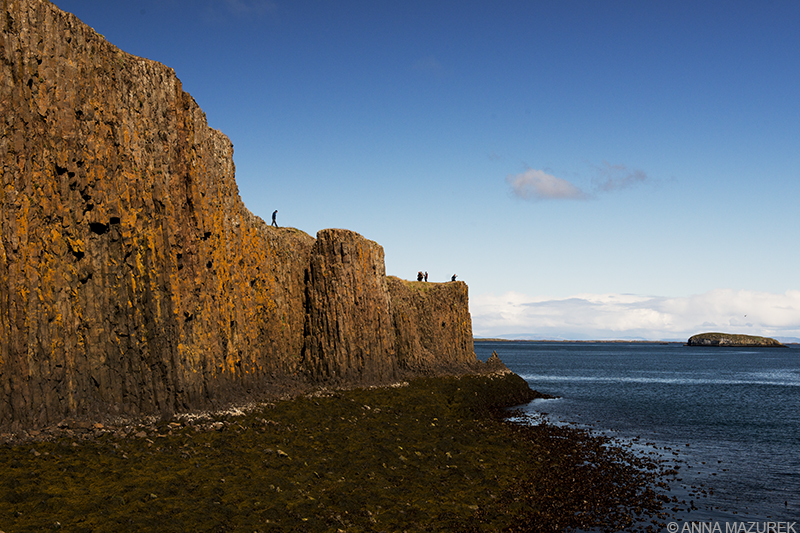
The basalt island of Súgandisey offers a great view across Stykkishólmur harbor and Breiðafjörður.
I rented a car – a 2WD Suzuki Swift hatchback that I named Sophia— the next day and headed north to explore Snæfellsnes solo. The 90km long peninsula was my favorite part of Iceland because it was packed with stunning landscapes. My first stop was Stykkishólmur, a quaint harbor town with a stone causeway linking the town to a basalt island (above) topped with a scenic lighthouse. The entire town has free wifi, and Nesbrauð, a budget-friendly bakery on the edge of town has excellent pastries and sandwiches!
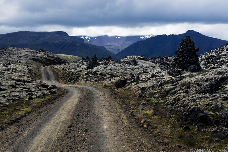
A four-wheel drive vehicle is not needed to drive the dirt road through Berserkjahraun Lava field .
A drive through the moss-covered Berserkjahraun lava field is a must. A dirt road winds through the lunar-like landscape formed by ancient lava dating back 3,000 years. The turn off to the loop road is on Route 54 just passed the intersection with Route 56. The sign is tiny and easy to miss.
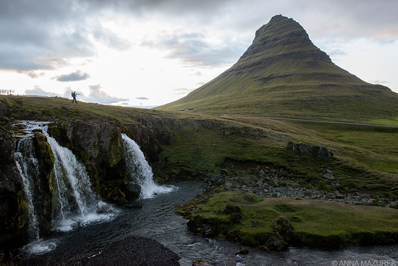
A photographer walks back to his car at Kirkjufell at sunset, which is roughly 11:30 p.m. in the summer.
You can’t miss Kirkjufell – it’s lush green peak makes it the most photographed mountain in Iceland. It juts out to sea on the edge of the town of Grundarfjörður. It’s stunning at any time of day. I photographed it three times – the first time in the afternoon, again at sunset around 11:30 p.m., then slept in my rental car so I could photograph it again at 5:30 a.m.!
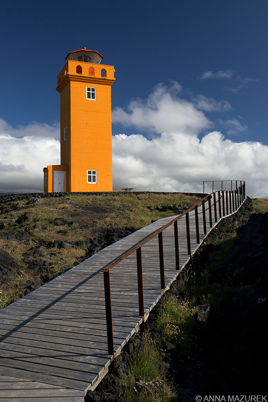
Svörtuloft Lighthouse in Snaefellsjokull National Park
Iceland’s first national park, Snaefellsjokull National Park, encompasses the far West end of the peninsula including a gorgeous stretch of rugged coast line, a volcano and glacier. One of my favorite scenic drives was the gravel Route 579 at the north edge of the park. The dead-end T-shaped road leads to two colorful lighthouses on each end with scenic cliff views.
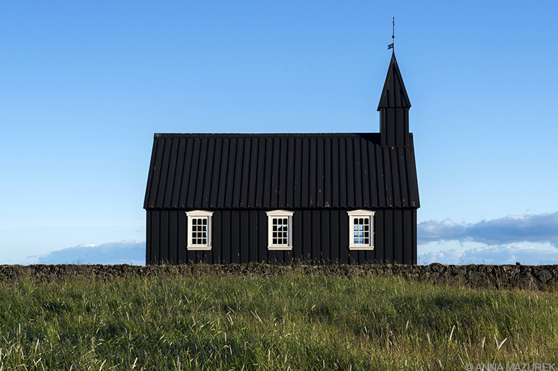
The black wooden church at Búðir was built between 1984-6 and is a replica of the original 1703 church.
Other park highlights were Djupalonssandur, a peddled beach scattered with the remains of a 1948 shipwreck, and Búðir, an barren lava field that’s home to a four-star hotel and a photogenic black church.
Northern Iceland
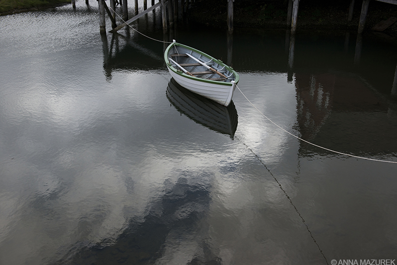
Siglufjörður
In the North, I took a detour off the ring road to drive around the Trollaskagi Pennsuila, which was one of my favorite drives. I stopped in the small, cute town of Hólar, the former capital of North Iceland. The center of town is home to oldest stone church in the country and cute turf houses.
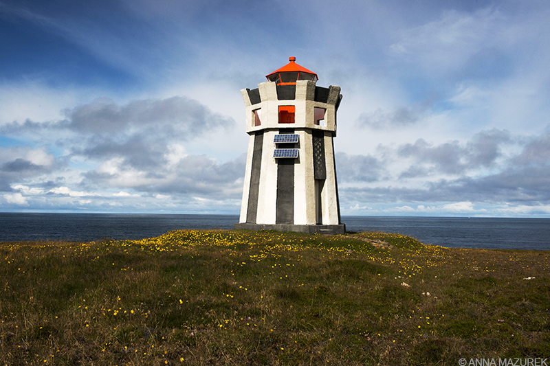
Straumnes lighthouse near Hofsos, Iceland
Since I’m obsessed with lighthouses, I was determined to find the isolated Straumnes lighthouse (above), which is located on a remote cliff north of Hofsos. Since Google was no help, I emailed the local museum. The director informed me that the roads were too bad for my 2WD-drive rental car, and he volunteered to take me in his 4WD truck! Everyone in Iceland is incredibly friendly and helpful. Anytime I needed help finding a remote location to photograph, I emailed the local tourism board or museum who always provided excellent directions. The lighthouse was located 3km down a rough dirt road on a farm that lies on the edge of a cliff about a 15-minute drive north of the village. During the drive, the museum director mentioned that as a child, he thought every country could see the northern lights! I totally wish I could have seen the northern lights as a kid on my parent’s South Carolina farm!
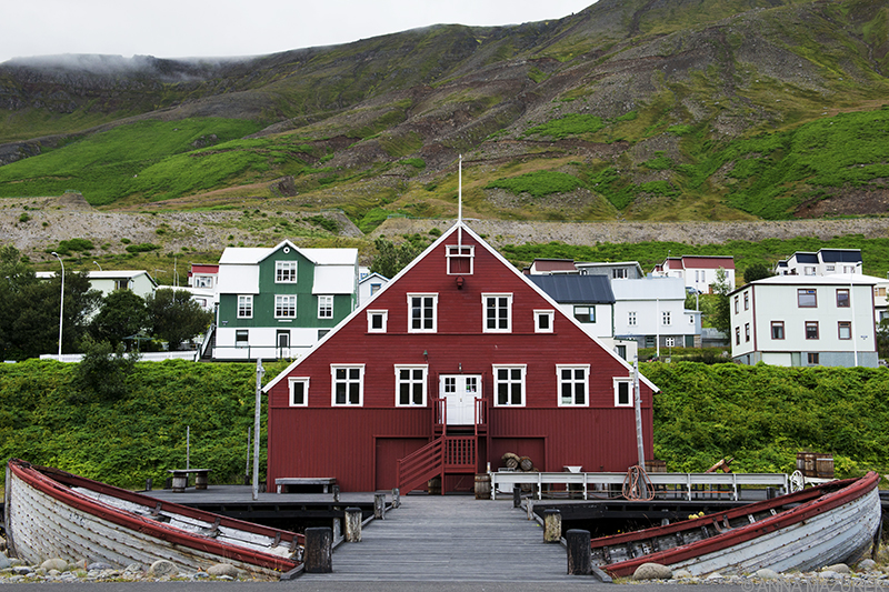
The Herring Era Museum consists of three picturesque buildings along the Siglufjörður harbor.
The most stunning village in Iceland is Siglufjörður, a small fishing village located in a scenic fjord accessible only by two scary one-lane tunnels with two-way traffic. (Seriously, it was the longest three kilometers of my life!) The town is home to the award-winning Herring Era Museum, which pays tribute to the town’s role at the epicenter of Iceland’s herring fishing industry. I only visited part of the museum and loved it!
I spent a night in Akureyri, Iceland’s second largest city, before driving to Lake Mývatn and Dettifoss, Europe’s most powerful waterfall. Dettifoss is accessible by a paved road, Route 862, for non-4WD vehicles. Go before 10 a.m. to avoid the tour bus crowds!
Blue Lagoon
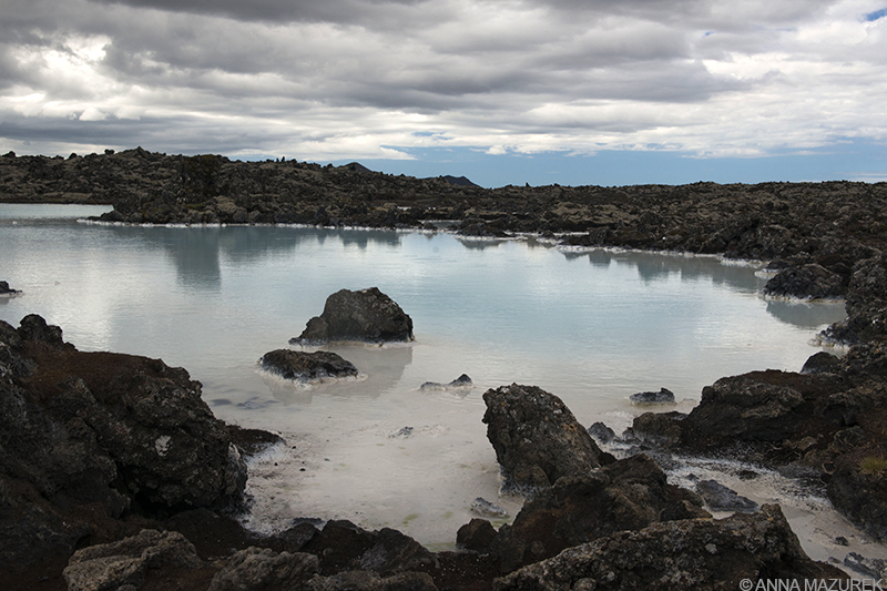
The pools outside the entrance of the Blue Lagoon are more photogenic than the lagoon itself!
I spent my last day in Iceland at the Blue Lagoon, a man-made geothermal spa located in a lava field not far from the airport. I honestly thought it was overpriced and overrated. Plus, the construction cranes and power plant in the background killed the view. The deserted pools outside the entrance were the most photogenic. I much preferred the geothermal public pools I’d visited on my trip. Every city in Iceland has a pool with a gym and a variety of different pool types and temperatures. (Entry is $6-8 USD.) My favorite one in Borg had a huge water slide! (No photos are allowed at public pools so I couldn’t shoot the water slide.)
Overall, I spent 10 days in Iceland and wish I had more time. I plan to go back during the winter months to photograph the northern lights and ice caves. You can never see it all in one trip! My only regret is not visiting Iceland sooner! What are you waiting for?!?
___________________________________________
COMING UP:
Budget Tips for Iceland
In the final part of my Iceland series, I breakdown my trip expenses along with budget and packing tips. As a bonus, I’ll share a few secrets for photographing Iceland’s top sites!
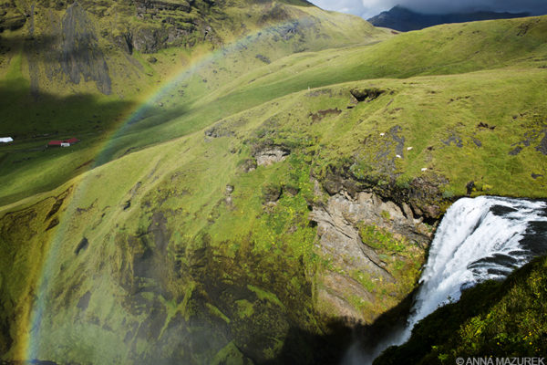
Skógafoss Waterfall

